Utility Easements: Implications for Utility Risk
Written by

Published on
May 2, 2022


Table of contents
We often think of utility risk in terms of the most obvious dangers: accidental utility strikes, surprise relocations, and costly delays. But there’s another major element that can seriously complicate our understanding of utility risk: easements.
Easement conflicts and utility risk can go hand-in-hand, creating headaches for all project stakeholders and adding a major challenge for utility coordination.
In this post, we’ll touch on the following points:
- What are utility easements? What is the public Right-of-Way?
- How do utility easements contribute to overall utility risk?
- How can utility mapping play a role?
What are utility easements?
An easement “gives a person, company, or government the right to use someone else’s real estate for a specific purpose.” Utility easements are easements that “give a utility operator the right to access and control the portion of another person’s land that is located near utility facilities and structures.”
Many different types of utility lines, including subsurface lines, have easements attached to them. These easements give utility operators permission for their lines to transverse the property of a private landowner—and they’re a critical element of any project planning process.
The exact details of utility easements can differ by state, utility type, and the specifics of a given property. Some of the key details to understand are:
Width:
Knowing the exact width of a utility easement is crucial. The width of a utility easement can differ by state and by utility type, and gas, oil, water and broadband easements can all have different characteristics. These widths can also differ on a case-by-case basis--a recent court case in Texas wrangled over the width of standard easements for electric power lines.
Utility placement within the easement:
Understanding the exact placement of a utility line within an easement is important for mitigating the chance of an accidental strike. There’s no guarantee that a subsurface line is placed in the middle of a utility easement, just as there’s no guarantee that field conditions match what’s drawn on an as-built record.
Ownership details (Gross or Appurtenant):
The ownership details of utility easements can differ depending on the type—and understanding the details of each case can be crucial. In general, utility easements that are between two entities (in gross) can change if a property has been sold to a new owner. Easements that are tied to a property (appurtenant) can remain even if a property has changed hands. Often, but not always, municipal and county governments hold the ownership details for utility easements.
Private utility easements differ from the public Right-of-Way. The public Right of Way (ROW) is land owned by a government operating agency or land that the operating agency has the right to use –most commonly for highways and roads. Many subsurface utility lines run in the public Right-of-Way, and projects that involve the public ROW require delicate utility coordination and utility relocations.
How can these easements contribute to utility risk?
Utility easements can contribute to utility risk in a few ways.
For example, a project site in Texas could contain multiple private properties. These each could contain several subsurface transmission lines with attached private easements crossing the property. They may also have surface power lines with their own easements, as well as subsurface broadband and telecoms lines with their own easements. Depending on the type of utility line, these easements can be of different widths and have different conditions attached to them. Project owners and estimators would need to take these easements into consideration, and to coordinate with the relevant stakeholders.
This doesn’t include unregistered gathering lines that don’t appear on any as-built records. These gathering lines could still be attached to a 20-foot-wide easement between the property owner and the gathering line operator, adding more complications. And if the lines (known and unknown) or property have changed hands since a line was first installed, or if a line is no longer in use? It can quickly become very hard to establish who the relevant utility stakeholders are and who has rights to elements of a project site.
Understanding who holds the rights to property within a project site, and if there are any restrictions on its use, is critical. Project managers, estimators, and engineers need to understand from the outset potential restrictions or complications that can influence the course and cost of a project. When stakeholders aren’t engaged early in the process, that can lead to delays, costly redesigns, and sometimes lengthy legal disputes.
How can utility mapping play a role?
The first step to dealing with potential utility easement conflicts is knowing what utilities exist on a particular project site. As we’ve discussed before on this blog, utility coordination is key for project success, and utility mapping can play a key role in setting a strategy for successful utility coordination.
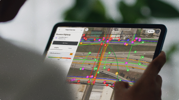
Utility mapping methods that integrate satellite imagery, historical imagery, and AI map generation techniques can show a complete subsurface picture at large scale from the beginning of a project—including many of the abandoned and unregistered utility lines that don’t show up on as-built records. That can help project managers and estimators understand where there are likely to be easements, as well as to get a sense of the many stakeholders involved in a given project site.
In addition, utility mapping can integrate metadata on the property owners involved with a given line, in turn shedding light on potential easements and directing project managers and estimators towards the right individuals. Utility mapping can also give insight into where a particular utility is located within a utility easement—helping everyone avoid accidental utility strikes.
Recent blog posts

Our Newsletter
Join 7k infrastructure professionals
Get monthly insights on ways to build smarter, faster and safer with Utility AI.

.avif)


