Utility AI Built for Smarter Infrastructure
Powering Smarter, Faster, Safer Infrastructure
4M’s Utility AI platform gives project teams instant access to reliable utility data and intelligent insights—all in one map, built for planning, design, and pre-construction.

Learn
How it works
Our advanced AI conflation engine gathers and organizes data from millions of public utility records, synthesizing it into a single comprehensive utility map.
The data is then validated through AI object detection, satellite imagery, and geospatial experts—delivering reliable, actionable insights project teams can trust and verify.

Powered by 4M AI

Powered by 4M AI

Powered by 4M AI
Our Platform
One Map. All Utilities.
Ready at Every Stage of Infrastructure

Concept Planning & Project Pursuits
Foundation Data
Lay the Groundwork for Success
Get instant access to reliable utility data so you can make smarter route selections and build stronger, more accurate proposals—faster, with fewer unknowns.
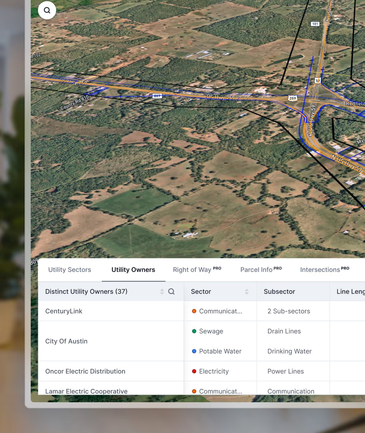
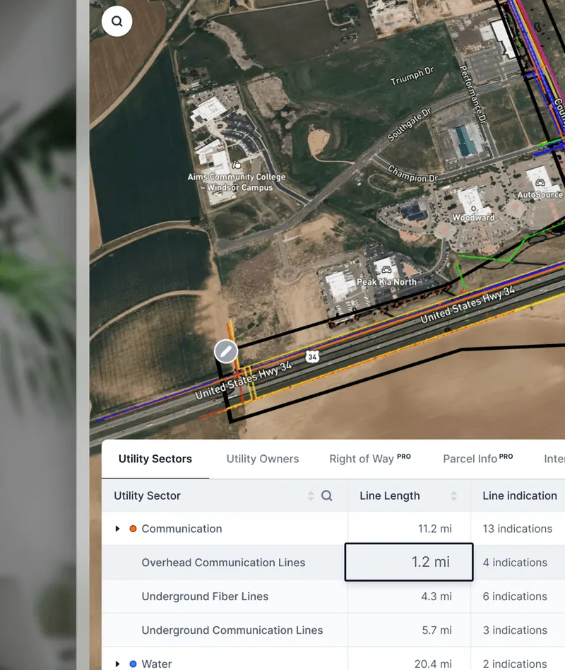
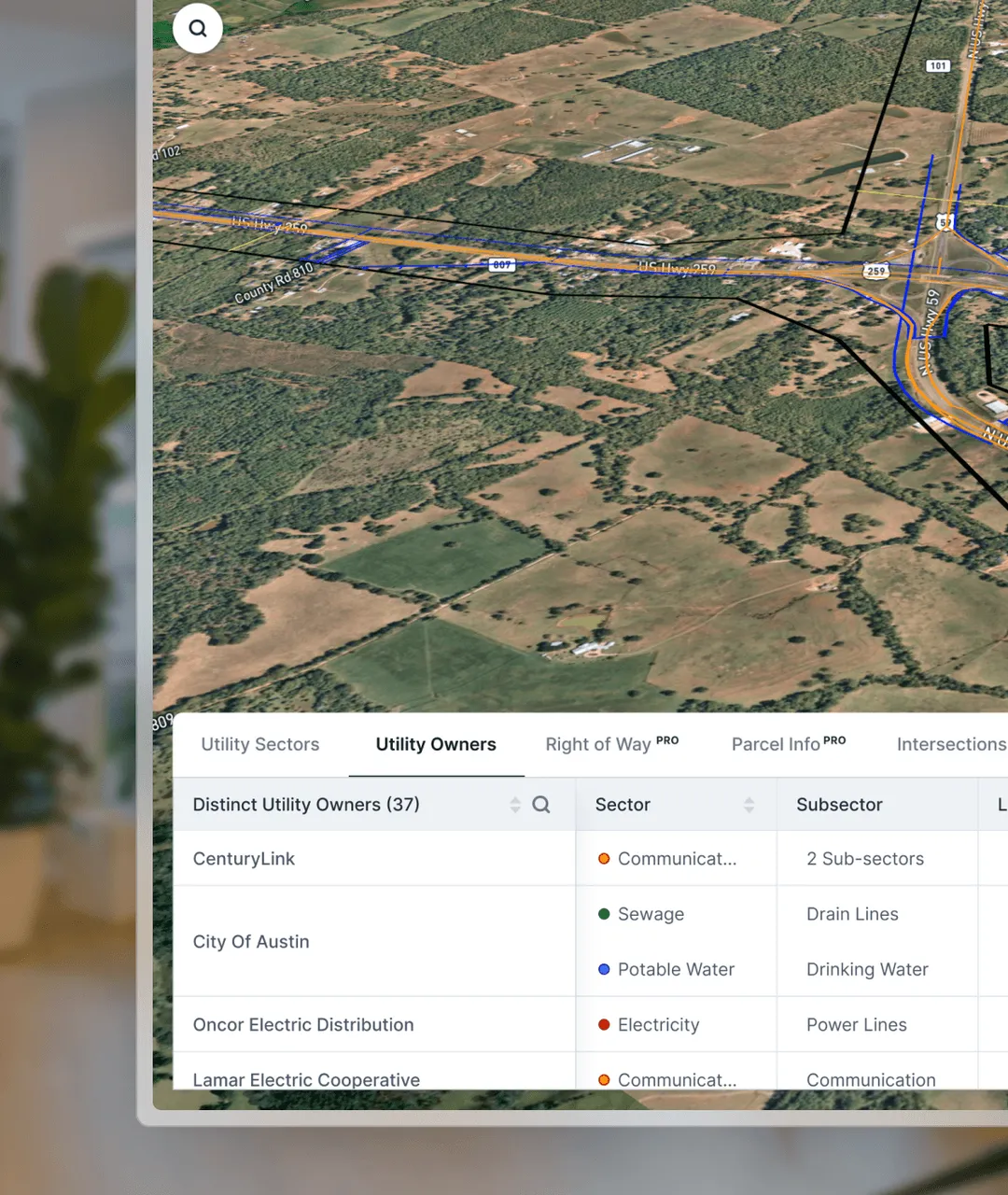
Specific utility lines, sectors, sub-sectors, and lengths
.avif)
Utility owners’ information and details
Utility crossing insights and feasibility assessment
.avif)
Utility type, elevation, size, material, installation date, and source
.avif)
Utility Density, Parcel Ownership , Typography, Floodplain and Right-of-Way.
.avif)
.avif)
.avif)
Preliminary Planning & Design
Utility Insights
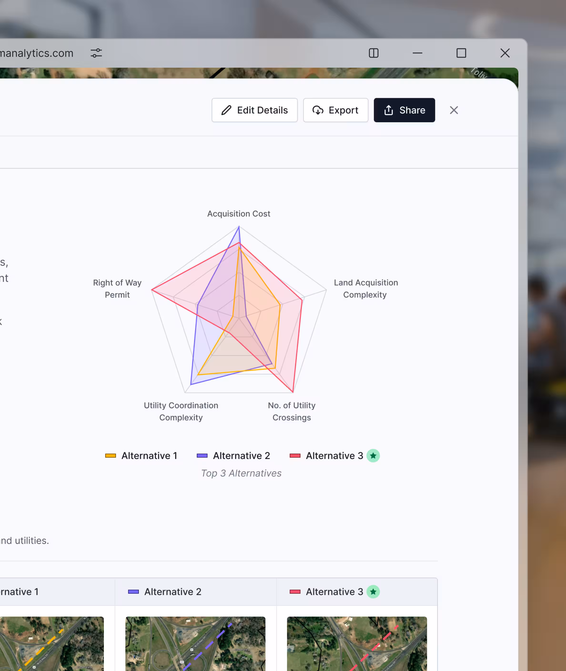
See the full picture. Plan with confidence.
Quickly assess utility conflicts, estimate relocation costs, and start design earlier with reliable data—reducing rework, field time, and utility surprises.
.svg)
Intelligent utility insights:
GenAI project analysis and insights
Estimate utility lines inside vs. outside ROW
Parcel ownership and easement analysis
Utility crossing risk levels and types
Detect large-diameter lines (20-inch+)
Total utility miles, number of utility owners
“This is exactly what we need—rapid access to the best utility information available to make better early decisions.”

Design & Field Readiness
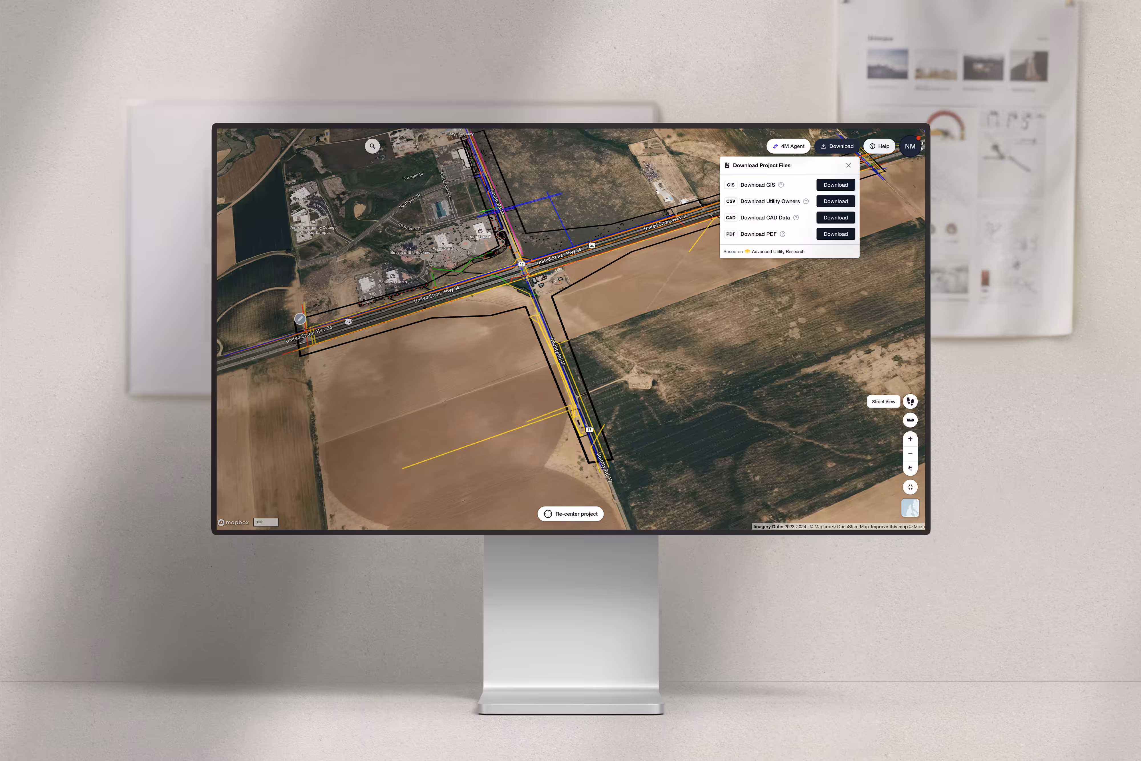
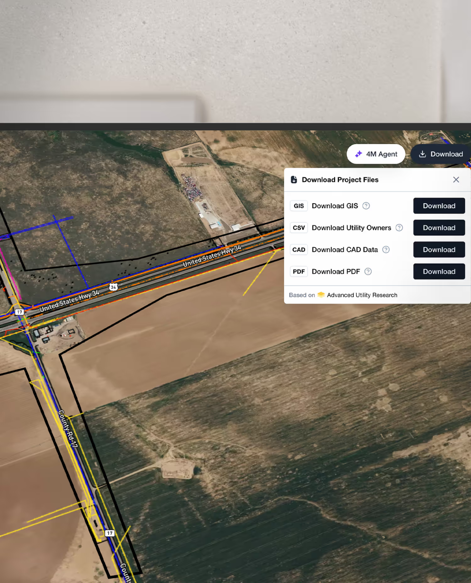
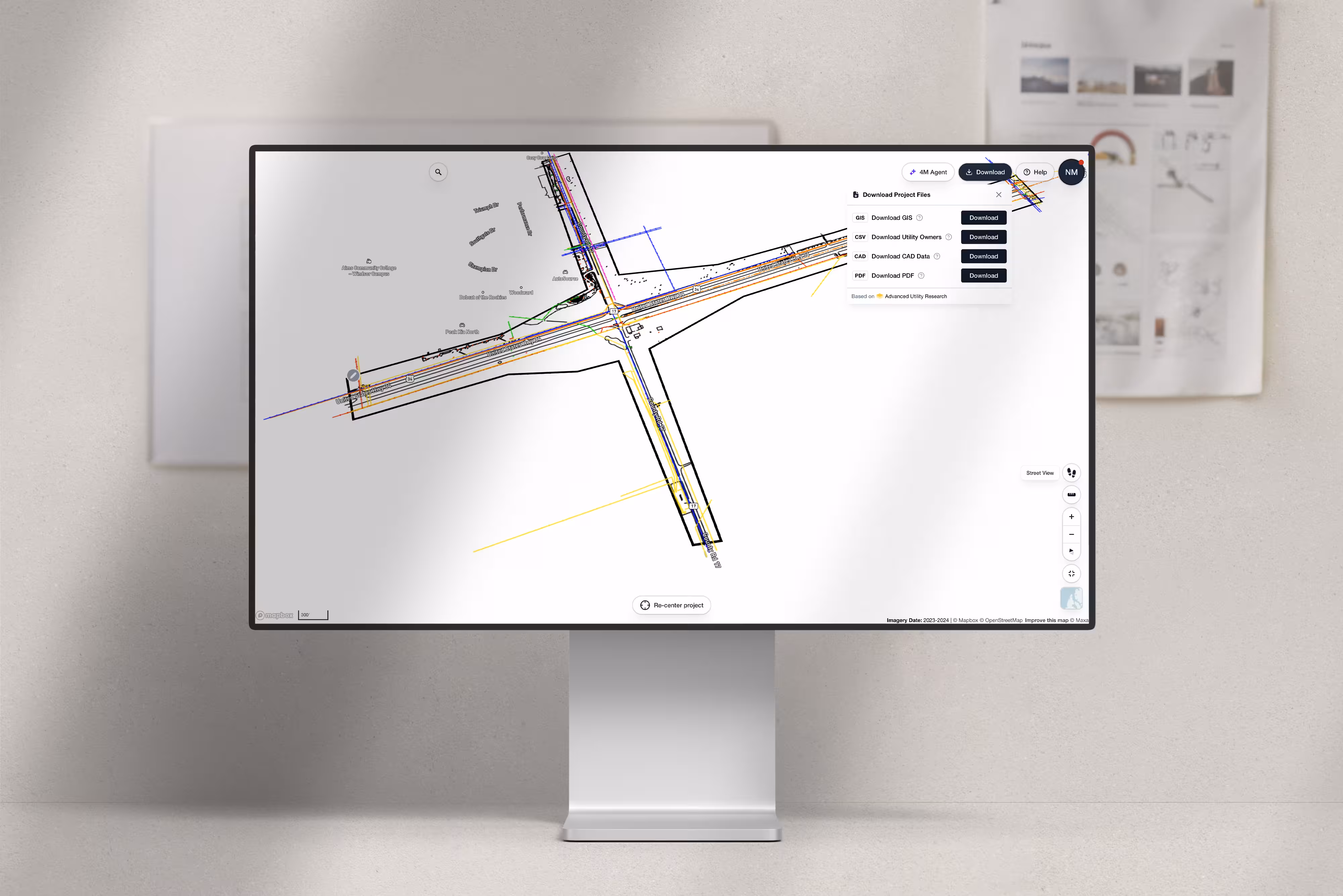
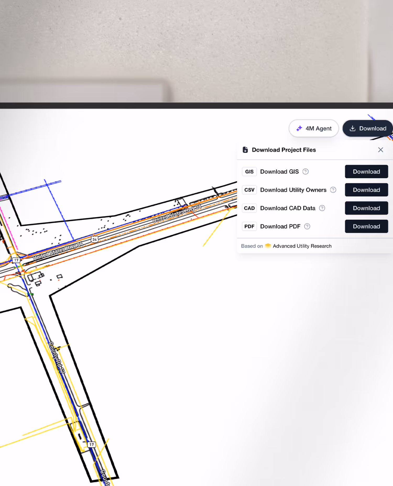
Export Data
Take your data anywhere,
in any format
Easily export utility data into GIS and CAD—so designers, coordinators,
and field teams can work from the same reliable source without disrupting their workflow.
Export formats: PDF, SHP, KML, GPKG, DWG, DXF, DGN
API access to extract project-level data directly from 4Map
Field Investigations
On-Surface Object Detection Know Where. Know What.
No Surprises.
Identify and verify above-ground utilities—enabling faster field mobilization, fewer site visits, and more confident QA/QC.

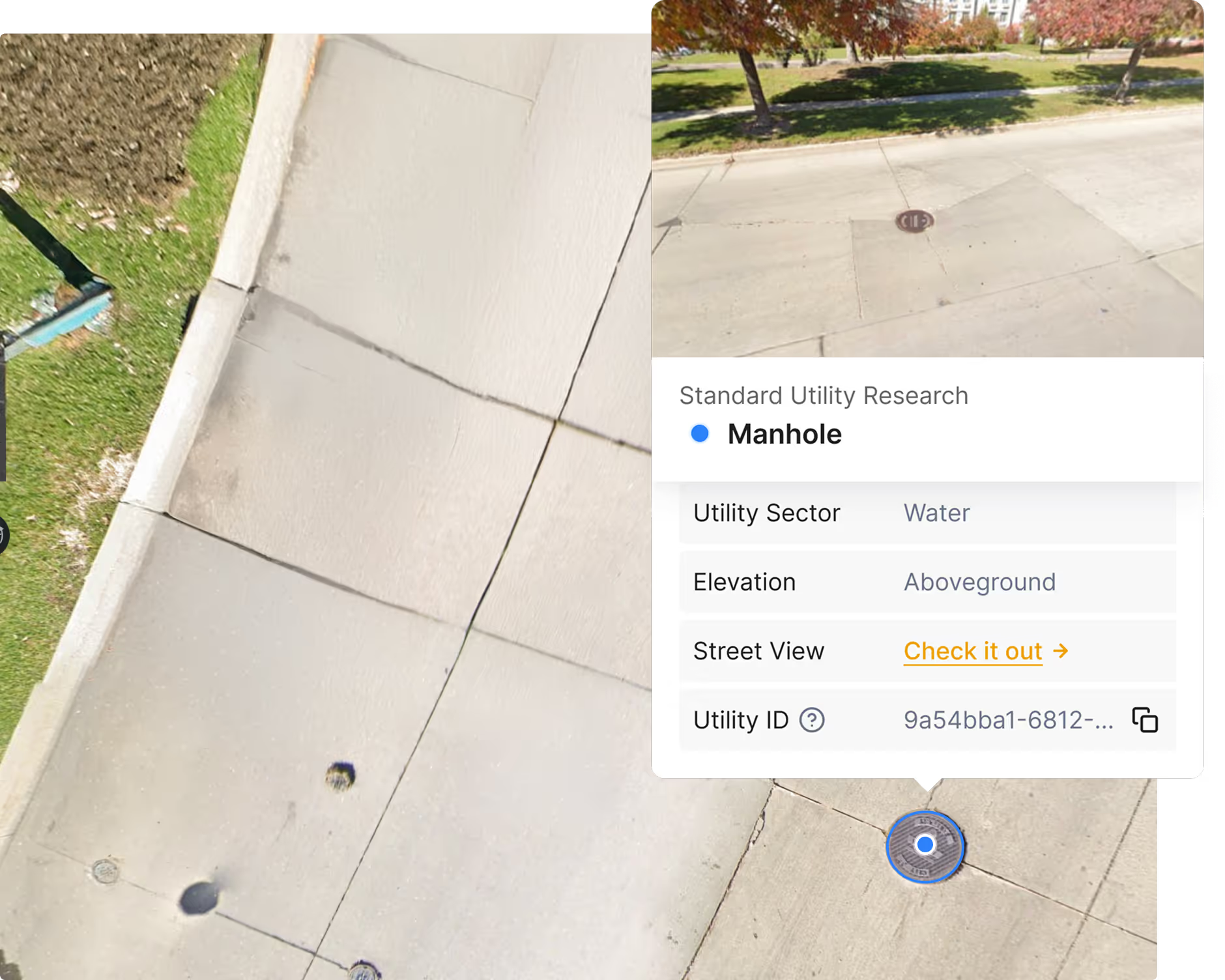
Manholes, inlets, valves, fire hydrants, pedestals
.avif)
Utility poles and classification
.avif)
Time-stamped satellite & Google Street view
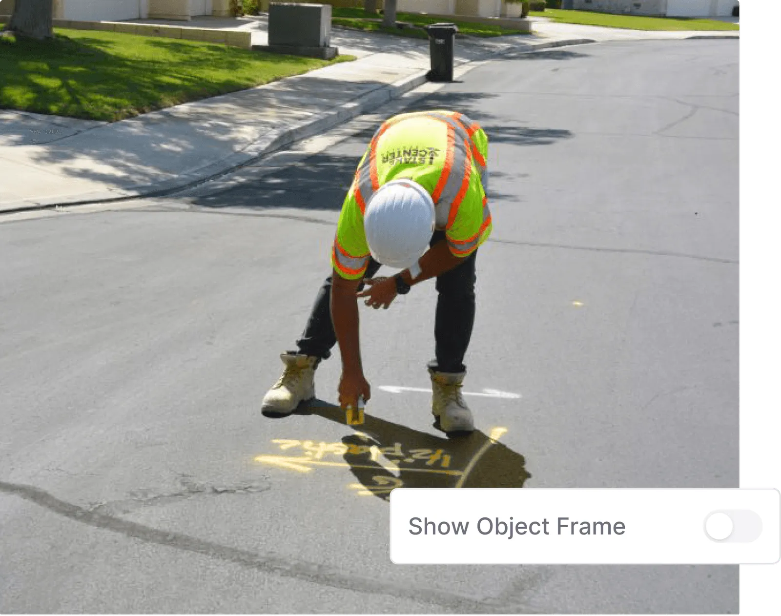
Road paint markings
Detect 85% of utility objects in your project, with 95% accuracy.
Industry Standards
ASCE 75-22 Complaint

Choose 4M-
because infrastructure demands smarter, faster, safer solutions and workflows.
Get Started
Ditch Outdated Utility Research Methods.
Get instant, reliable utility data for confident upfront project planning.