Transforming Infrastructure with Advanced Utility Data
Written by

Tamar Shafrir
Published on
August 21, 2025
.avif)

Table of contents
The hidden costs of unknown utilities—and how to solve them
Increasing costs on materials and components, rising overheads, compressed timelines, and higher competition for bids—the construction industry has little room for error when it comes to maintaining owner cost-benefit and contractor profitability. Any source of uncertainty must be assessed, quantified, and mitigated to ensure successful outcomes. So why does the number one risk factor for transportation construction projects often go unacknowledged?1
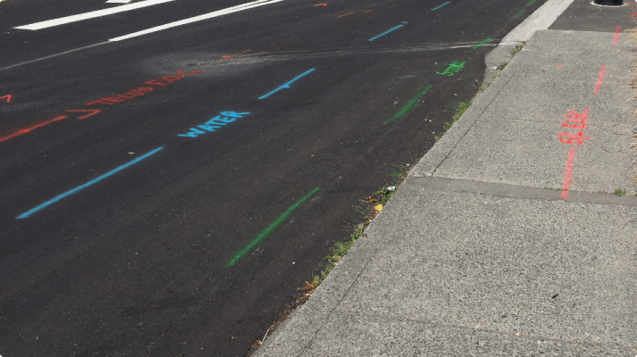
Unknown utilities on a site create various risks, some of which are difficult or even impossible to accurately quantify using traditional or statistical methods. The most obvious risk is accidental damage to utilities, putting the lives of excavator operators, construction workers, and local residents on the line in up to 30% of projects.2 Yet damages and injuries only scratch the surface of utility-related risk.
The bidding process creates liability for both project owners and contractors, who often negotiate utility risk transfer in an antagonistic manner. Discovery of unknown utilities during excavation can derail construction schedules and budgets, especially when utility relocations are the only solution by the time they are found. In the best case scenario, the contractor is forced to file a high number of claims or change orders to deal only with unidentified utilities. In the worst case, these disputes lead to years-long lawsuits with millions of dollars at stake and untenable litigation costs for both parties.3
Though utility risks seem neglected, there is near-total consensus on the fact that they exist and cause significant problems for a variety of stakeholders. Project owners need to close-out projects on time and under budget and cannot tolerate utility-related delays or disruptions in customer service. Utility owners don’t want their assets damaged, resulting in costly repairs and disruptions of customer service. Engineering consultants must avoid last-minute redesigns and additional work beyond the original scope. Contractors must protect their staff from safety risks while ensuring that any additional costs are recouped.
Accessing Utility Data Remains a Problem
Given these shared interests in identifying utilities, avoiding utility conflicts, and protecting utilities from damages, why does the problem remain? One issue is the lack of clarity on who owns the problem. Is it the project owner, even if they don’t own the utilities on site and aren’t aware of their locations? Is it the utility owner, even if they aren’t aware of and don’t control what construction activities take place around their assets? Is it the general contractor, who may not have had an accurate picture of site conditions during the procurement process? Understandably, no one wants to take ownership of the problem if it requires assuming the consequent liability.
It’s crucial to understand why the problem exists: the lack of a unified repository of comprehensive, reliable, and up-to-date utility data.4 It may be surprising to learn that many utility owners do not keep comprehensive location records on their own assets, and may have acquired unidentified utilities through mergers and acquisitions.5 Due to the funding structure of modern project management, projects often lack budget for thorough site investigations until late in the design phase, with new utility conflicts being identified during preconstruction or even after excavation has begun. Though it would help general contractors to assess utility risks during the bidding phase, the cost of traditional utility locating techniques is far beyond their available budget for pursuits.
As a result, all stakeholders have become accustomed to relying on incomplete utility data derived through labor-intensive site visits and traditional locating methods. Increasingly, that data arrives too late to support project outcomes that avoid utility conflicts. For example, over 50% of 811 “Call Before You Dig” tickets are not located within the allotted timeframe, meaning over half of excavators cannot begin digging on time.6 In other words, it appears that another solution is still required to solve the problem of utility risk for construction planning and design.
A 21st-Century Solution to Utility Data
What would this solution look like if it could really fix that problem? First, it would be a unified repository of comprehensive utility data with an easy to use platform to interact with that data. If every utility company had perfect records of their own assets, the data would still be siloed into separate databases, and no insights could be derived from the relationships between different buried assets or from the total overview of all utilities on the site. Designers need a single platform that maps the entire project site, not 8 different partial data sets for each of the utility companies active in the project area.
Second, that solution would leverage AI and other advanced technologies to collect up-to-date utility location data at scale, without putting boots on the ground every time the information is needed. Whether from blueprints, records, and as-builts, or from satellite and street-level imagery, massive amounts of data would be collected, conflated, and integrated into a single map. Any detected changes in the project site or in available documentation would be automatically updated on the platform. Computer vision algorithms would be used to perform object detection and instantly identify surface features of utility assets across the entire site, recognizing each manhole, utility pole, pedestal, and valve. Every utility asset would be catalogued by type, size, owner, year of installation, and more. The turnover time for receiving utility data would shrink from up to 3 months to a matter of seconds.7
Third, that solution would empower project owners and civil engineering teams with AI-powered features for route planning, right-of-way planning, risk assessment, rapid testing of alternative project layouts, proposed resolutions of utility conflicts, and early coordination with utility owners. While utility data is valuable as such, it only matters if it enables better planning and design and reduces utility conflicts and damages. By accessing utility data early in the project lifecycle and seeing how utilities impact planned construction, stakeholders can more accurately select best-cost options, minimize contingency from utilities, prevent project delays, and reduce future change orders and claims from general contractors dealing with last-minute utility conflicts.
Benefits and Use Cases
How would this innovative solution to utility data be implemented by stakeholders, and what benefits would they derive? For utility owners, instantly available data sets would lead to accelerated planning and permitting for new transmission and distribution lines or grid upgrades, including opportunities to coordinate co-location or joint trenching with other stakeholders. More comprehensive data showing the complete subsurface and aboveground environment would also improve integrity management, resiliency initiatives such as undergrounding, and overall asset management for better operations and maintenance. Finally, easier methods of sharing and updating data would lower the costs and increase the efficacy of damage prevention, including faster resolution of dig and design tickets through 811 “Call Before You Dig.”
For project owners in the right-of-way, namely state departments of transportation, improved access to utility data could fundamentally transform the often adversarial relationship between public agencies and utility owners.8 Roadway construction projects would be designed to minimize utility conflicts and unnecessary utility relocations while creating new potential transmission corridors, fostering a shared interest between stakeholders in selecting the optimal routing. At the same time, project owners and engineers would integrate utility data earlier into planning and design, resulting in more transparent and appropriate procurement processes. Instead of shifting risk between stakeholders, project owners and general contractors would work together to reduce utility risk.
For civil engineers, project managers, and contractors, increased availability and coverage of utility data will be one of the key factors in solving the capacity problem in contemporary construction. AI technology will not replace any job roles. Instead, it will empower the existing finite labor force to deliver on ambitious construction targets, in order to expand and upgrade current infrastructure to 21st-century demands. By merging high-quality utility data into engineering and construction software platforms, including building information models (BIM), stakeholders can use advanced modeling and analysis tools to their full potential and extract more value and higher ROI across the entire project team.
Driving a Mindset Shift
The solution for unknown utilities driving up construction costs and schedule overruns is not just a new technology. That technology has to drive a mindset shift across several sectors, from construction to utilities, about how we deal with the complexity of the subsurface and street-level environment. Until now, utility risks and conflicts are simply accepted as unavoidable—often with disastrous implications for the bottom line, to say nothing of harm to life and property. Now that comprehensive, up-to-date utility data is becoming available at scale and instantly, there’s finally an opportunity to evolve the way we design and build around existing utilities so that unplanned disruptions and unsustainable risk levels become a thing of the past. The only question is how quickly stakeholders will use this newly available data to their competitive advantage.
Want to take this with you? Download the paper here

Tamar Shafrir
A dedicated researcher that doesn’t stop investigating until she reaches the truth, no matter how hard it is to accept or comprehend (and there are a lot of those in our industry). Tamar took her first career steps in architecture and design, both as a practitioner and a journalist. Throughout her journey, her curiosity has taken her all across the globe, from North America through Europe to the Middle East, discovering and explaining the micro and macro challenges of the industry. Today she focuses most of her efforts on unlocking the challenges of the subsurface, through research and education.
Recent blog posts

Our Newsletter
Join 7k infrastructure professionals
Get monthly insights on ways to build smarter, faster and safer with Utility AI.


