Why You Should Always Locate Utility Lines Before Digging
Written by
.avif)
Chris Garafola
Published on
May 18, 2022


Table of contents
The bottom line: Locating utility lines is a crucial element before beginning to dig for a project. Beyond the potential legal consequences, digging before locating utility lines can be dangerous and in the long term, extremely costly.
In this post, we’ll touch on the following points:
- What are the potential consequences of missed utility lines?
- What are some common best practices for locating utility lines?
- How can utility mapping play a role in addressing utility risk?
What are the potential consequences of missed utility lines?
We’ve discussed at length on this blog some of the serious consequences that can come from finding an unexpected subsurface utility in your project site. Utility strikes, redesigns, and utility relocations can all bring with them significant risks and unexpected costs—not to mention legal headaches and reputational damage.
Accidental utility strikes can be extremely dangerous. Take a look at the dramatic consequences of a relatively small utility strike:
By the time an excavator starts digging, it’s already too late to start thinking about locating utility lines. And knowing where subsurface utility lines are in given project site is crucial to avoid dangerous strikes like this one.
According to the Common Ground Alliance, there are over 450,000 utility strikes annually in the United States. In the worst cases, these utility strikes can be deadly. But even when utility strikes don’t cause any physical harm to onsite workers, accidental utility strikes can be extremely expensive. These strikes cause direct costs of upwards of $30 billion a year, and the full amount of these costs may be even higher. While establishing the indirect and social costs of utility strikes is notoriously difficult, some studies suggest that indirect and social costs of utility strikes exceed the direct costs by a ratio of 29:1.
But utility strikes are just a part of the story. Discovering an unexpected utility line during construction, or even late in the design phase, can cause huge headaches for everyone involved in a project. A surprising subsurface utility landscape can bring with it a whole host of problems: delays, unexpected relocations, cost overruns, as well as extensive legal wrangling and legal fees to settle disputes over liability.
What are some common best practices for locating utility lines?
Fortunately, there are some existing and new tools to enable project stakeholders to understand the subsurface landscape of their project before they begin digging.
Call 811:
811 “Call before you dig” centers offer free utility marking services in every state. These services receive as-built data from public and private utilities and mark the locations of subsurface utilities in a project site using paint markings and flags. However, 811 services are only as good as the as-built utility data that they receive—which is often incomplete and unreliable. Calling 811 before digging is a legal requirement in most states in the US for every project that involves significant excavation.
Use Subsurface Underground Engineering (SUE) providers:
SUE companies specialize in locating underground utilities. These engineers use a range of different locating methods, including ground-penetrating radar (GPR), vacuum excavation, potholing, electromagnetic locating, and metal detection.
Utility Coordination and Utility Strategy:
Early utility coordination is key to locating utility lines and managing utility risk. By getting all utility stakeholders involved early in the project process, project managers and engineers can get the best information about potential utility conflicts in their project area well before breaking ground. Utility coordination is a successful part of setting a holistic utility strategy to manage utility risk throughout the project lifecycle.
How can utility mapping play a role in setting a successful utility strategy?
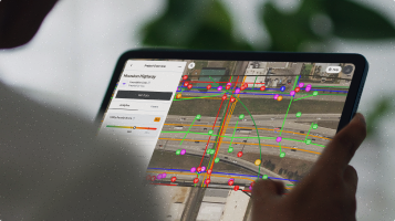
Utility mapping allows project managers, estimators, and engineers to get a clearer image of the subsurface from the very beginning of the project lifecycle. Equipped with quality subsurface data, all project stakeholders can maximize utility coordination and manage utility conflicts from the outset ---avoiding expensive utility strikes, costly redesigns, and time-consuming utility relocations.
A utility strategy that integrates utility mapping can give project owners and project managers more confidence in their bids, allow them to price risk better and bid more effectively. Utility mapping can also give Subsurface Utility Engineering (SUE) experts a roadmap for their locating efforts—minimizing time spent in the field and reducing the number of boots-on-the-ground required to locate utilities in a project site.
Recent blog posts

Our Newsletter
Join 7k infrastructure professionals
Get monthly insights on ways to build smarter, faster and safer with Utility AI.


