What is a Utility Locator?
Written by

Chris Garafola
Published on
November 27, 2023
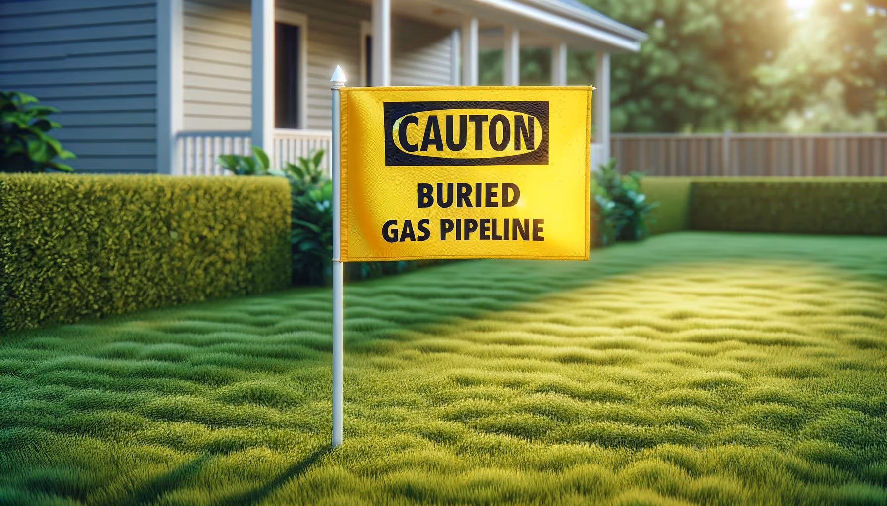

Table of contents
Utility locators play a crucial role in several industries — including construction, excavation, and landscaping — by identifying and marking underground utilities.
Ensuring accurate utility detection is a utility locator's primary responsibility — because knowing where the lines are ensures the safety and success of a project. In this article, we'll look at what utility locators do, the techniques and tools they use, and their collaborative role in project execution.
Use the links below to jump to what you need:
What do utility locators do?
Why is accurate utility detection important?
What techniques and tools do utility locators use?
What skills does a utility locator need?
Why is collaboration essential to the role of utility locator?
What do utility locators do?
Utility locators spend their days identifying and marking underground utilities to prevent damage and accidents. Their tasks include conducting surveys, analyzing utility maps, and using specialized equipment to locate utility lines. By accurately identifying the location of utilities such as water, gas, and electrical lines, utility locators help construction teams work safely and efficiently.
Why is accurate utility detection important?
Accurate utility detection prevents unexpected damage to utility lines — otherwise known as a utility strike. Damage to underground utilities often requires costly repairs and project delays. It also poses risks to the safety of workers and the public. Common Ground Alliance reports that more than 450,000 utility strikes occur each year in the United States — and some strikes can be deadly. Utility locators play a critical role in minimizing risks by ensuring that construction activities avoid damaging utility lines. Their expertise and precision contribute to the smooth execution of projects and the overall safety of the work environment.
What techniques and tools do utility locators use?
Utility locators employ various techniques to detect underground utilities, including:
1. Electromagnetic (EM) Locators
Using an electromagnetic radio frequency transmitter and receiver to identify utility lines, an EM locator sends out a radio signal at a specific frequency. The pulse transmits through conductive material in a segment of subsurface. Sending the signal through a piece of surface infrastructure, such as a water valve, allows the locator to trace the connected pipe beneath the surface with a great deal of accuracy. For situations where there's no above-ground piece of infrastructure to connect with, locators can use induction — but the accuracy will not be as high.
2. Ground-Penetrating Radar (GPR)
Ground Penetrating Radar (GPR) uses electromagnetic pulses to discover the location of underground utility lines. First, the GPR transmitter sends high-frequency radio waves (between 10 MHz and 2.6 GHz) into the ground, which pass through objects under the surface and are distorted by conductive and dielectric properties. When those distorted signals return to the GPR receiver, the software analyzes the results and displays contrasts between objects and depth information. To be successful, GPR must detect a significant difference between underground objects' electrical and magnetic properties. GPR is extremely effective for utility location — and damage prevention — because utility lines are often made of metal.
3. Acoustic Methods
For situations where GPR and EM locators do not function well, innovators have developed other techniques — such as acoustic methods — that send patterns of sound waves into the soil. Then, a receiver records and processes the time it takes the sound waves to bounce back, using that information to estimate depth. Acoustic methods can be more successful than GPR in certain situations, such as soil that includes sand or is very saturated.
4. Potholing
Potholing involves creating small test holes to gather details about the buried lines, including their horizontal position, depth, type, and any signs of damage. Potholing is commonly used by work crews to prevent accidental damage to water, electrical, gas, telecommunications, and fiber optic lines — ensuring that projects are completed as planned and within the allocated budget.
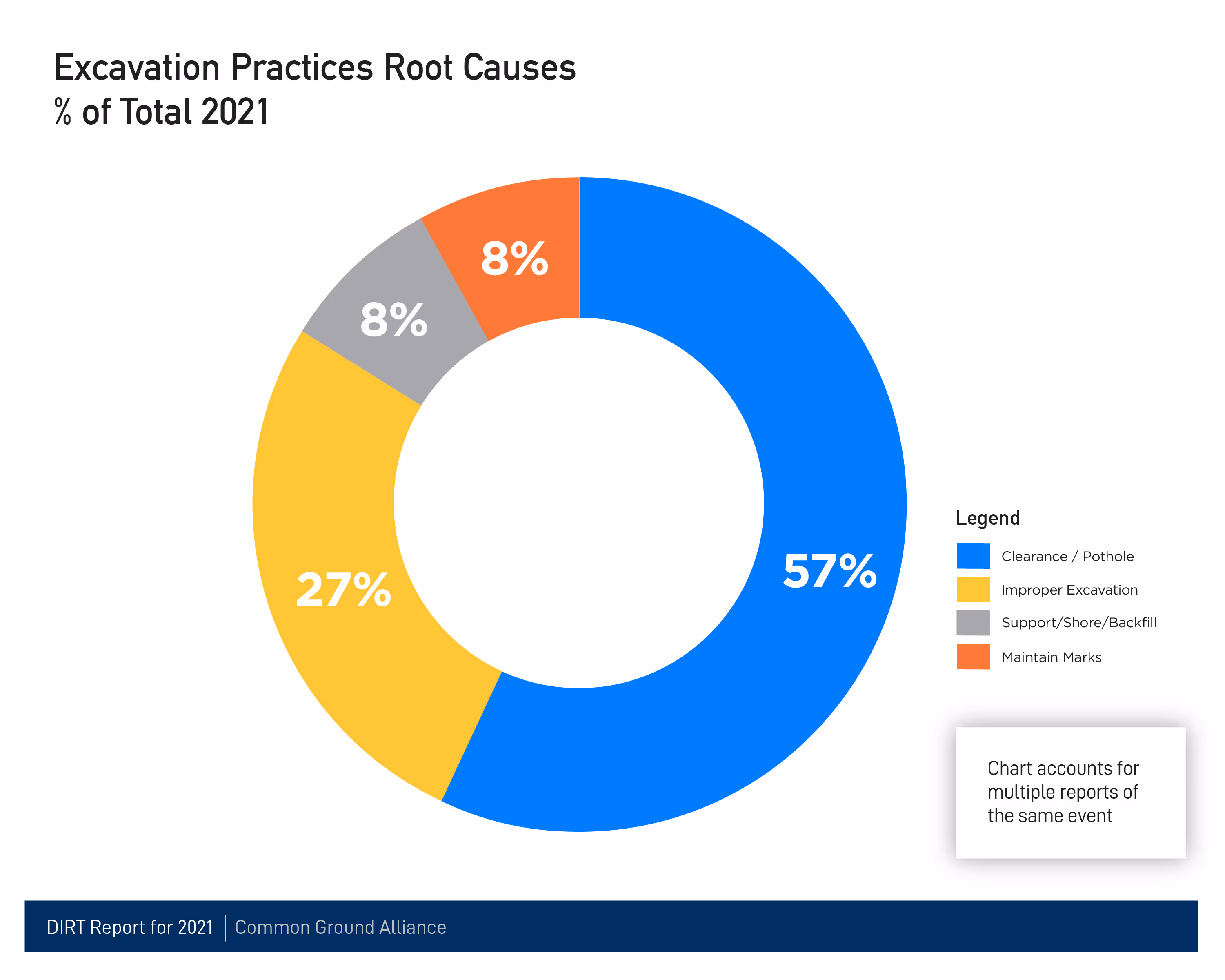
Compared to other methods like utility mapping and electromagnetic (EM) locating, potholing is a highly accurate approach for utility location. Despite being time-consuming and labor-intensive, it's crucial. According to a recent DIRT Report by The Common Ground Alliance, failure to pothole is a primary factor in the majority of damages resulting from excavation practices.
Each utility locating technique has its own applications and limitations, and utility locators are trained to select the most appropriate method based on the specific project requirements.
What skills does a utility locator need?
Thinking of becoming a utility locator? Here's what you'll need:
- Knowledge of utility systems and their characteristics
- Proficiency in operating utility locating equipment
- Ability to interpret utility maps and survey data
- Physical strength and coordination, including the ability to lift and carry heavy loads up to 80 pounds
Relevant certifications and training programs can enhance a utility locator's qualifications and expertise. To become a certified utility locator, individuals must complete a series of steps that include attending a course, passing assessments, and gaining practical experience.
Why is collaboration essential to the role of utility locator?
Utility locators work closely with construction teams, utility companies, and project stakeholders to exchange accurate data and ensure that all parties know the location and characteristics of underground utilities.
To be successful, utility locators need to have excellent communication and collaboration skills. Their ability to locate utilities accurately and then communicate that information to stakeholders is essential to preventing utility damage and ensuring that construction or excavation crews can carry out their projects safely.
Utility locators play a pivotal role in keeping projects running safely, smoothly, and on time. Their expertise and use of specialized techniques and tools help prevent disruptions, accidents, and costly repairs.
Recent blog posts


Our Newsletter
Join 7k infrastructure professionals
Get monthly insights on ways to build smarter, faster and safer with Utility AI.