Words from our CEO – Itzik Malka
Written by

Itzik Malka
Published on
January 15, 2021


Table of contents
Let me tell you a story. One that is never talked about but touches each and every one of us.
Two thousand years ago the Romans found an intelligent way to use gravity and underground tunnels to carry water between their cities. This is how it all began, mankind’s use of the underearth. What started with water systems, worked for sewage systems, electricity grids, oil & gas pipelines, communication, and even transportation.
This is the story of the underearth.
We don’t see it, but we all use it….every day, in every part of our lives.
In the past century, this story took a drastic turn, as the subsurface started filling up. What was once the emptiest space on earth, has now become a complicated environment that hides countless miles of man-made infrastructure. And this is just the beginning. In the coming decades, as poverty decreases, countries prosper, and our world becomes more and more physically connected, the use of the underearth is going to skyrocket.
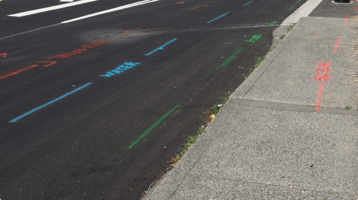
The thing is, we have no idea how to manage this, as we just don’t know what is buried and where. Even in the most advanced countries, subsurface infrastructure blueprints are either nonexistent or extremely inaccurate, causing strike, after strike, after strike. Besides safety issues concerns, events that result in delays and unexpected costs, do something much worse – they cut off human beings from their most basic needs; being able to turn on the light, cook, or just watch TV.
In order to save our story, this has got to stop, and we know-how.
We’ve found a way to take a look into the subsurface, to see the unseen, to pinpoint the exact, up-to-date, location of any man-made underground infrastructure. And we can do this everywhere from anywhere, from your offices or ours.
Our software platform, a combination of remote sensing, artificial intelligence, and computer vision, makes manual records – redundant, field investigations – automated, geophysical locating – scalable, and the need for utility exposing – minimized. Essentially, if compared to current solutions, we deliver accurate subsurface mappings at a penny on the dollar and at a tenth of the time. And you know what – that’s not all!
We see how our platform can do much more than that. We can create conflict maps, use an app to prevent excavator strikes, solve RCP scenarios, and help stakeholders get the permits they need to start digging. And this is just for the utilities sector. Imagine what we could do in agriculture, environment, and even defense.
Going back to our reality, at a time when we can’t even quantify the mileage of infrastructure that is expected to be buried in the next year, not to mention the next decade, having an accurate and current understanding of the subsurface terrain is crucial, and we are the ultimate solution for doing so.
This our story. One that starts with the Romans, continues with our current challenges and evolves with 4M Analytics into the future.
This is the story of the underearth.

Itzik Malka
Navigating the depths beneath our feet is more than just a mission for Itzik Malka; it's a relentless passion that has led him to co-found 4M Analytics, a groundbreaking Infrastructure & Utility Mapping Tech-Company. With an entrepreneurial spirit coursing through his veins, Itzik envisions a world where the hidden infrastructures below us are not mysteries, but accessible maps that drive humanity’s progress. His pioneering drive seeks to replace blind trenching with a digital repository, revolutionizing the way we navigate underground infrastructure. By harnessing a variety of cutting edge technologies, Itzik's team is rewriting the rules, offering real-time, cost-effective data that solves one of the greatest challenges civil engineers experience today.
Recent blog posts

Our Newsletter
Join 7k infrastructure professionals
Get monthly insights on ways to build smarter, faster and safer with Utility AI.


