Utility AI Mapping Decoded: Civil Engineers' Perspective
Written by

Published on
November 22, 2023


Table of contents
TL;DR:
- Old vs. New Methods: AI-driven utility mapping is more efficient than cumbersome traditional methods.
- Civil Engineers' Perspective: Wes Kaisershot and Fred Garza discuss how utility AI mapping technology helps them reduce costs, save time, accelerate project proposals, and win more bids.
- Addressing Talent Shortage: AI mapping technologies fill critical labor gaps with civil engineers, ensuring project continuity and efficiency.
- Confidence Levels in Utility Data: 4M's multi-tiered data offerings (preliminary, standard, advanced) cater to diverse project requirements, enhancing planning and execution.
- Competitive Advantage: Instant access to utility data gives firms a strategic edge in winning new contracts.
- Adopting New Technologies: Wes and Fred encourage the industry to embrace AI for better efficiency and project success.
Just a few years ago, creating a detailed utility map meant digging through paper records and as-builts, potholing, and traveling back and forth between project sites to meet with stakeholders.
With the advent of new technology — such as artificial intelligence (AI) utility mapping — those laborious processes are getting easier. Best of all, construction teams get more data earlier in the game — during planning and design instead of days before breaking ground.
In a recent webinar, Wes Kaisershot, PE, Director of Engineering at SurvWest, and Fred Garza, RCDD, OSP Director of Utilities & SUE at CivilCorp, joined Lizzie Laster of 4M Analytics to share their expertise using AI utility mapping as a tool to inform construction projects early in the planning stages, cut costs, save time, and win more bids.
Looking back: How civil engineers mapped utilities in the past
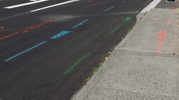
Five to ten years ago, civil engineers mapped utilities the old-fashioned way. Adhering to the 38-02 standard for best practices from the American Society of Civil Engineers, they collected records via 811/One-Call systems by contacting utility owners and looking for field markers.
🕒 It was a time-consuming process.
"We didn't have the technology that we have today, such as smartphones and tablets with fast internet connections from the field," says Garza. One of the challenges they faced was the distance to the project site. "If the site was 100 miles from where you were sitting, that became a big challenge time-wise."
Other challenges included getting the right data from the right people, finding civil engineers who were well-versed in utilities, and a lack of standardization between utility systems.
Modernizing utility mapping with AI
Google Earth and Maps were early breakthroughs for desktop visualization of distant project sites, says Garza. "Google Maps gives us the luxury of looking at a particular place from our computer from wherever we are." In one case, Garza could compare current images with historical images to identify when a piece of infrastructure had been installed, solving a liability dispute. "That was the first step in being able to sit in your office chair and get something like that resolved in a matter of minutes."
When today's AI tools are applied to utility mapping and SUE, they can eliminate many of the industry's previous bottlenecks and speed up the data collection process dramatically. AI-powered utility mapping provides data much faster than traditional methods can, bringing utility conflicts to light earlier in the process and improving safety.
"The AI that we utilize today is such a blessing in the sense that we can get utility information in days instead of weeks or months," Garza says. "If somebody told me just five years ago where we'd be today with AI, I would have told them they were crazy. We've made huge advances in a short timeframe — and it means we can get customers their utility data much faster."
AI utility mapping: solving the talent shortage
With the current high demand for infrastructure projects coupled with a shortage of engineers and technicians, AI mapping is helping fill gaps and keep projects moving despite the talent shortage.
"You have federal monies coming in for a whole lot of infrastructure, yet there's such a demand for good labor right now," says Kaisershot. "It's hard to fill those roles, so AI utility mapping is coming in and actually helping fill some of those gaps and get projects done faster."
How SurvWest achieves significant time savings with 4M Analytics
Up until recently, Kaisershot was skeptical of the value of AI for subsurface utility mapping. "I was thinking AI was going to take my job and the jobs of others away," he says. "But now, I see it's actually making us more efficient."
Case in point: Last winter, a client hired SurvWest's SUE team to locate a gas line in an area of downtown Denver, Colorado, that is very dense with underground utilities. The area had lots of snow followed by rain, posing extra challenges for the crew.
But on this project, they decided to give 4M Analytics a try. "We went in there, and the 4M data showed the undocumented gas line right away," Kaisershot says. The utility map helped SurvWest's crew narrow the scope of where to perform their SUE methods, allowing them to pinpoint the exact location of the gas line much faster than if they used only traditional methods. "Our designators are really good, but the assistance of the AI engine and having the historical knowledge of when those lines were placed helped us find those utilities quickly."
The client was impressed — and Kaisershot was convinced that AI utility mapping offers significant time savings for SUE professionals. "With 4M Analytics, we can get the data upfront and send designators out to confirm it's there."
How CivilCorp accelerates project proposals with instant utility data
Garza and his team at CivilCorp also started out skeptical about Utility AI Mapping, so they decided to put the technology to the test. "We picked a project we had already done the SUE work on and then requested the information from 4M Analytics, just to see how much we could trust it," he says. "We were impressed with how accurate it was."
For a recent bid, CivilCorp obtained 13 miles of utility data through 4M in minutes, allowing them to include that information in the proposal — and impress the potential client.
Using AI utility mapping as a competitive advantage
The speed and efficiency of AI mapping give SUE professionals a competitive edge. Clients want utility data instantly, and AI tools empower engineers to deliver it quickly, setting firms apart when they are pursuing new contracts and clients.
"Today, if someone tells me they've got a project in Texas, I know it'll only take a minute or two to pull a heat map that will tell me the density of the utilities in that area, and maybe a couple of days to get the actual line work for that area," says Garza. "It's a huge difference from how we used to do things — and it means I'll be ready to present our plans to the client in a matter of a few days."
Confidence levels of 4M Analytics utility data
4M's AI-driven utility mapping and analytics solution offers three levels of data — preliminary, standard, and advanced.
- Preliminary utility research provides real-time access to 4M's proprietary utility data, compiled from existing utility records and public information. Includes access to utility density score, number of utility owners by sector type, and utility insights such as aggregate length of above and below-ground utility lines.
- Standard utility research delivers enhanced data validation and a more comprehensive view of utility location, owners, and key attributes, including elevation, line length, material, size, and installation date. Standard data meets needs for early planning and inventory development.
- Advanced utility research provides our highest level of data validation by leveraging visually verified, recent, and historical satellite and aerial imagery. Advanced data uses change detection technology to identify abandoned or undocumented lines and incorporates them into your project map. This top tier of data is useful for critical locations like bridge crossings, helping to increase certainty for high-risk areas.
"Because we're a SUE firm, we're finding the best strategy right now is to get the standard data," says Kaisershot. "Then we go out and get boots on the ground to confirm it and find any lines that were missed. Any additional information we get back at the end can feed back to 4M to improve their accuracy for next time."
Skillsets needed to use AI utility mapping
SUE skills are still needed to analyze and validate AI data — and to continue improving the utility map for a given area.
In the future, Kaisershot and Garza see a need for 3D maps of underground utilities, which would help with class detection and conflict analysis before a project starts. "Today's clients don't just want nice orange, green, blue, and yellow lines on a paper with a legend and an engineer seal," Kaisershot says. "They want the conflict analysis. They wanted to move toward utility coordination. And now that we know where all the utilities are in that congested corridor, how do we get them clear of this roadway where we're widening our road two lanes each way?"
While 3D modeling of underground utilities isn't commonly available yet, AI-assisted maps are paving the way for future developments.
Adoption of AI utility mapping and change management
For now, AI utility mapping holds great promise — but it's no secret that the construction industry can be resistant to new technology. SUE firms must educate their employees about the benefits and alleviate their fears.
"We're seeing that many folks in our industry are starting to come around," says Garza. "Even construction contractors are getting on board a little faster than some others. They’re realizing it’s time to change our mindset."
Advice to engineering firms hesitant about using AI for SUE
For firms still uncertain about incorporating AI into their workflows, here are a few steps to take.
- Adopt a flexible, open mindset. Cultivate curiosity about how new technology could improve your processes and save time and effort for your crews.
- Put 4M Analytics to the test. Get the data on an area where you've already performed SUE work and see for yourself how accurate it is.
- Consider how new technology could optimize your processes and improve your bottom line. When you're trying to get new contracts, access to AI utility maps could mean you have the information you need in time to win that business.
"I would encourage you to be a lot more open-minded," Garza says. "The future is in AI because it's so much faster, so much more efficient, and it'll help you get a lot more projects done in a shorter period of time."
Recent blog posts

Our Newsletter
Join 7k infrastructure professionals
Get monthly insights on ways to build smarter, faster and safer with Utility AI.

