The Hidden Cost of Broken Utility Data: Why We All Pay the Price
Written by

Chris Garafola
Published on
October 27, 2025
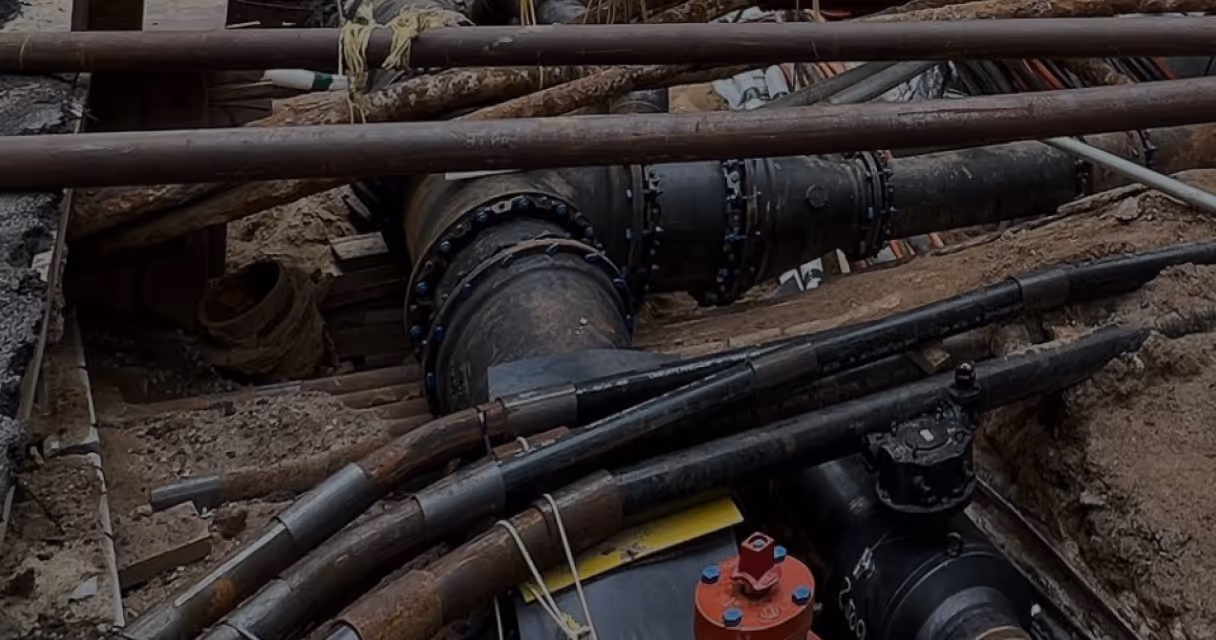
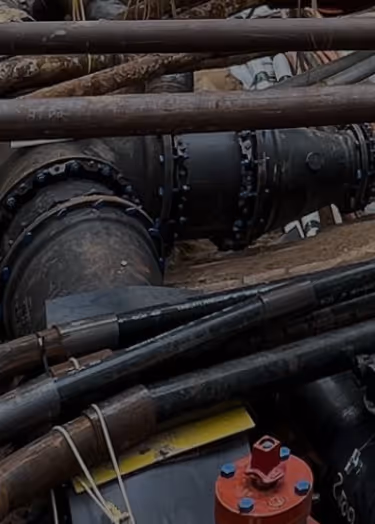
Table of contents
Every time you flip a light switch, turn on a faucet, or drive down a newly constructed road, you're experiencing the end result of a complex underground infrastructure network. But what we typically don't see—and what we’re all unknowingly paying for—is the chaotic mess of disconnected data, outdated records, and siloed information systems that plague the utility industry.
The reality is stark: right now, at this very moment, we are all financially shouldering the burden of incomplete utility data.
Whether you realize it or not, these inefficiencies touch every aspect of our lives, from the utility bills in your mailbox to the tax dollars funding public infrastructure projects. That impacts every community across the US, every family, and every resident.
The Web of Hidden Costs
The financial impact of fragmented utility data ripples through society in ways most people never consider. As utility customers, we absorb the costs when projects run over budget due to unexpected utility conflicts. As taxpayers, we fund the expensive relocations and redesigns that could have been avoided with better coordination. As property owners, we face the costs and delayed services when excavators hit unmarked gas lines or fiber optic cables.
Engineers design around incomplete information, leading to suboptimal and reactive solutions. Contractors build contingency costs into their bids to account for the inevitable surprises lurking beneath the surface. Subcontractors face project delays that cascade through entire supply chains. Even as building occupants, we experience service disruptions when utility assets are damaged due to poor coordination.
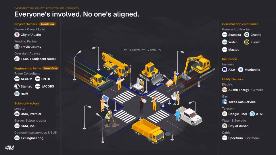
The scope of this problem is even bigger than we imagine because of the number of entities and people involved in a project. Just one project on an intersection in Austin, Texas brings together dozens of different stakeholders:
- The project owner
- The funding partner
- The oversight agency
- 6–8 different types of utilities: electricity, natural gas, water, wastewater, telecommunications, oil, hazardous materials, etc.
- 10–20 different engineering consultants
- 10–20 different general contractors
- 10 different subcontractors doing locates, surveys, and subsurface utility engineering
- Excavator operators
- Installation subcontractors
- Insurers for every contractor and subcontractor
- And of course, local residents and businesses relying on utility service
Every one of these stakeholders is stuck using a 20th-century system to build 21st-century infrastructure. We're operating with a patchwork of disconnected workflows, incompatible data formats, and outdated plans that were never designed to integrate seamlessly.
And that means we all suffer the consequences of that siloed utility data, as well as bearing that financial burden. But what if we could work together to break those siloes down and share data instead?
The Missing Piece: A Unified View
The scope of this coordination challenge becomes clear when you consider that dozens of stakeholders converge on every project site. Companies, consultants, contractors, subcontractors, and agencies all bring their expertise to our most vital infrastructure projects, yet no one's aligned.
Every participant works with siloed utility data in various formats that are either incomplete, outdated, or missing entirely, making it impossible to get a comprehensive picture of the overall site circumstances without boots on the ground.
The fundamental problem is that there's no connective data infrastructure helping stakeholders to begin projects from a shared baseline, to keep information current across project phases, and to close out projects successfully. One team might rely on decades-old CAD drawings, another uses hand-marked field sketches, while a third depends on GIS coordinates that may not align with actual infrastructure locations.
The problem is simple to identify, but the impacts are devastating: costly utility strikes, planning errors, construction delays, reduced resiliency, and inadequate modernization of the infrastructure grid.
These consequences affect everyone involved, from the project owner determining the site footprint to the civil engineer designing the 3D model, from the project manager coordinating between the back office and the site to the excavator operator breaking ground. We're all held back by increased risk due to the lack of comprehensive, up-to-date utility maps for every project site.
But what if we could change this fundamental disconnect? What if we could bring people together earlier in the process, drive better alignment and transparency, and improve outcomes across the board?
Without this unified foundation, we’re stuck trapped in a cycle of inefficiency in three critical areas:
Coordination failures between public agencies and utility owners lead to unnecessary and expensive relocations that could be optimized or eliminated entirely with better planning.
Asset protection suffers as excavator operators and installers work with incomplete information, increasing the risk of dangerous and costly utility strikes.
Design planning remains reactive rather than proactive, with engineers forced to navigate utility conflicts after the fact rather than designing to prevent them from the beginning.
A Shift in Mindset is Making Change Possible
For decades, the utility industry operated under a culture of secrecy and competition. Companies kept asset location data private, citing security concerns or competitive concerns as reasons for keeping information locked away. This resistance to collaboration created additional layers of inefficiency and risk for everyone involved, particularly the communities affected by delays and utility strikes.
However, something fundamental has changed in recent years. The underground space has become increasingly congested with infrastructure—power lines, gas mains, water pipes, telecommunications cables, fiber optic networks, and more. This congestion, combined with the escalating risks and costs associated with utility strikes and conflicts, has reached a tipping point.
The economics of the situation have flipped. The cost of not collaborating now far exceeds any perceived benefits of keeping data siloed. Stories about utility companies unable to share critical information were once common, but we’re currently witnessing a dramatic shift in attitude.
There's a growing recognition that instantly accessible utility data provides greater value than the old model of protective secrecy ever could. When a single utility strike can cost tens of thousands of dollars and a single utility conflict hundreds of thousands; when service disruptions can affect thousands of customers; when accidental damages can create safety hazards for workers and the public, the math becomes clear: collaboration isn't just a nice-to-have—it's essential.
The Path Forward Together: Utility AI Mapping
The transformation begins with a simple but powerful concept: what if everyone involved could instantly access the same reliable data at every stage of the project? What if this data was available on one platform, accessible wherever you work, and seamlessly integrated into the tools, systems, and workflows you already use?
This vision is becoming reality through 4M’s Utility AI mapping platform that delivers instant, reliable utility data everyone can trust and verify. The platform serves as connective tissue that unifies every stakeholder from project planning to maintenance, helping teams stay connected and informed across the entire project lifecycle. By integrating easily with existing infrastructure workflows and tools like Trimble, Esri, and Bentley, 4M helps industry professionals work together better from the same central source of truth.
When everyone involved uses the same reliable data, the transformation is remarkable: projects move forward quickly, decisions become clearer, and outcomes improve dramatically.
No more incomplete blueprints patched together in incompatible formats. No more misunderstandings between project teams. No more last-minute discoveries of utility conflicts in the project right-of-way.
Powerful Data, Empowering People
The cornerstone of futureproofing our infrastructure relies on professionals collaborating and working better together, using the same data to drive smarter decisions throughout the project while ensuring the safety, success, and profitability of everyone involved.
That data is available on 4M’s Utility Mapping platform: we’re the first company mapping infrastructure at scale and across all project sites, using AI and machine vision to close the gaps in utility data coverage. The transition from traditional utility mapping to AI utility mapping is here, and it’s changing our industries and our communities for the better.
And while data alone can't futureproof our infrastructure, people, empowered by reliable data, can.
The future of infrastructure isn't siloed. It's better together. And we’ll build it together with 4M. Book a demo to see how 4M can help you build smarter, faster, and safer infrastructure today.
Recent blog posts


Our Newsletter
Join 7k infrastructure professionals
Get monthly insights on ways to build smarter, faster and safer with Utility AI.