AI Mapping for Subsurface Utilities: The Future of Underground Infrastructure
Written by
.avif)
Chris Garafola
Published on
October 20, 2025


Table of contents
Every 60 seconds in the United States, someone strikes an underground utility line. Every 60 seconds, somewhere in the world, someone steps on a landmine. The parallel isn't coincidental — both represent invisible dangers lurking beneath our feet, and both require innovative solutions to prevent tragedy.
Itzik Malta, founder and CEO of 4M, started his career in the Israeli special forces as a landmine disposal specialist. While we've made significant progress in landmine detection, America's underground infrastructure remains largely invisible, creating a crisis that costs billions in delays, damages, and occasionally, lives.
But a new approach combining artificial intelligence with military-grade detection techniques, thanks to Itzik’s experience, is finally bringing the subsurface into focus. He recently appeared as a guest on the Energy Central podcast — here’s a recap of the most insightful parts of that conversation.
Main Episode Takeaways:
- The 811 system struggles with a project backlog, meaning utility markings are delayed in 55% of projects, and access to utility data can take weeks or months due to a lack of centralized subsurface utility records.
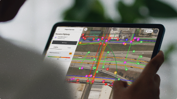
- 4M's AI-powered system creates underground maps from scratch by combining legacy blueprints, satellite imagery, and object detection technology to provide real-time, verifiable subsurface data.
- The shift from protective data silos to collaborative data sharing is essential for modern infrastructure projects, where up to 60 different entities must coordinate around the same underground space. 4M gives utilities the power to complete that mapping and to make the rate case for the cost.
How the 4M Utility Mapping Engine Works
Traditional mapping applications like Google Maps and Waze were built upon existing road networks and satellite imagery. But when 4M Analytics set out to create the Google Maps for underground infrastructure, Itzik faced a fundamental challenge: there was no base map to start with.
“If you take other mapping applications like Waze or Google Maps or others, they started from other base maps that they could use,” he explains. “In our case, there wasn't anything that you could take and say, this is not a good depiction of what's below, but I'm going to use it as something. We didn't have anything.”
Instead, 4M had to build the underground map from scratch using a sophisticated AI-powered process that combines multiple data sources:
Data collection and standardization: The system ingests millions of records from legacy sources — including blueprints from software providers such as Bentley, Esri, and Autodesk — that have been isolated in silos for decades, and standardizes them so that they’re useful and accessible to everyone who needs the data. “We standardize utility data in a way that produces a foundation that displays our interpretation of what's below the ground,” Itzik notes. “It's a process of collection with cleansing, scoring, and vetting of the millions of records that we could find.”
Conflation and amalgamation: Advanced algorithms superimpose different data sources, even when they use different coordinate systems or have gaps in coverage. The challenge is almost archaeological, piecing together decades of infrastructure development. “How can you take different sources without coordinate systems, some of them with different coordinate systems, and superimpose them together? What do you do in places where you have low coverage or no coverage at all? Taking blueprints and being able to georeference them in their physical location and digitizing them — that's another phase,” Itzik says.
Visual verification through object detection: Most importantly, the system uses computer vision to identify surface indicators of underground infrastructure. “The image science that we have invested in is the validation and object detection capabilities, which we developed to extract from images any feature that you could think of: from pedestals, valves, and inlets to electrical poles, streetlight poles, and manholes — anything that we could really use as an indicator that something is connected and runs below the ground.”
Continuous updates: Unlike static databases that use a snapshot in time to provide reports, the conflation process in 4M runs daily. “If a customer wants us to give an update every week, or every day, we could use the constellation of imagery that we have to provide what has changed.”
More Than a New GIS Database
The difference between 4M's approach and traditional GIS databases runs deeper than technology. Instead of acting like a utility that just delivers water through existing pipes with no further guidance on how to best use and conserve this valuable resource, “think of us as the plumbers that come with the water,” Itzik says.
While GIS systems can host and manage data, they don't generate the comprehensive underground picture that infrastructure projects require. This meant that building the 4M database had to be about more than simply digitizing a large set of blueprints, but also adding visual verification with object detection so users can validate what’s there for themselves.
The disconnect between design and reality creates a persistent problem in the industry. When infrastructure is designed using digital modeling platforms, there's often no reliable connection between what was planned and what was actually implemented in the field.
This is where "as-built" documentation — records of what was actually constructed — becomes crucial. But getting those records into the system can take two to five years, meaning projects often start with outdated or incomplete information.
“The database is based on existing utility records and not usually on any image science validation, so they contain errors and don't account for deviations,” Itzik notes. 4M's visual verification system enables users to click on any mapped element and view satellite imagery evidence, creating a “trust but verify” approach to underground infrastructure data.
The 811 Problem: When "Call Before You Dig" Isn't Enough
The 811 system—America's “Call Before You Dig” hotline—was designed to prevent underground utility strikes. In theory, it's simple: call three days before digging, and utility companies will mark their lines. In practice, the system is delayed in 55% of excavation sites.
What should be a three-day process stretches into weeks or months. Projects that depend on accurate subsurface information face delays that can extend timelines by 3 to 4 months. The coordination between the dozens of entities involved in a typical infrastructure project becomes a logistical nightmare.
“In general, utilities take a reactive approach to strikes,” Itzik explains. “The fundamental problem is that utilities are not aware of all excavation activity taking place around their assets. So it's almost impossible for them to prevent them.”
Sharing Data Increases Trust and ROI
For decades, many utility companies have treated their infrastructure data like state secrets, locked away behind what Itzik calls “castles.” They may regard the data as sensitive business information, especially in competitive industries like broadband coverage.
Or, in many other cases, they simply don’t have comprehensive and accurate data on their own assets. “Some of them never collected it,” he says.”Some of them have been acquired over the years through M&As, and nobody wants to hand over the data sources. Some have records in inaccessible analog formats, and some of them are out of date or have imprecise data that you can't really use.”
The cost of gathering, cleaning up, and providing this data is unaffordable for many utilities—one small natural gas provider told the Pipeline and Hazardous Materials Safety Administration (PHMSA) in 2023 that the cost of mapping their own network would literally bankrupt the company. And in the cases where they could afford it, there’s no business case to be made for undertaking that expense, in cost as well as employee resources.
But this reactive and protective approach is increasingly counterproductive in an era of rapid infrastructure modernization.
“In many conversations over the last five years, and some of them from those protecting the data behind castles over the years, they've become very open-minded,” Itzik observes. “And that's because I think they've seen that the value of sharing the data is much greater than the protective approach they had.”
The economics are compelling when you consider the complexity of modern infrastructure projects. A single utility upgrade can involve 60 different entities: 20 engineering firms bidding on design work, 20 subcontractors, over 30 utility owners, and insurance providers. All of these stakeholders need to coordinate around the same physical space, but they're working with isolated, incompatible systems and a lack of reliable data.
“What we are trying to create is the digital social network they're going to use to really speak with each other,” Itzik explains. “It's a transparency issue. It's trust. And the only way to measure trust, a customer told me, is by the speed with which you get to make a decision that will impact the time that the public gets its services.”
Supporting Infrastructure Modernization
The timing of this underground mapping revolution couldn't be more critical. America is in the midst of massive infrastructure modernization driven by electric vehicle adoption, transmission grid upgrades, data center construction, and broadband expansion. Each of these initiatives requires extensive underground work, and each faces the same fundamental challenge: not knowing what's already there.
Transmission upgrades and grid resilience: Utilities face increasing pressure to underground power lines for resilience against hurricanes, wildfires, and extreme weather events. “Until recently, undergrounding power cables was considered too expensive to be realistic, but the devastating events in California and also in Florida mean we must do it,” Itzik explains. Accurate subsurface mapping can significantly reduce planning and permitting schedules, enabling these vital projects to be completed before the next disaster.
Broadband expansion: The race to expand fiber optic networks has created new categories of utility strikes. “There's a lot of commercial competition between the telecom companies to provide connectivity to different places, but the rapid rollout of broadband has caused a significant number of utility strikes due to horizontal directional drilling. Some telecom companies have even been placed under restraining orders by counties due to the number of strikes they have had.”
The solution isn't just better technology — it's a completely different approach that provides comprehensive tools to avoid strikes and mitigate risks before conflict becomes a risk, when it's manageable and at its lowest cost point.
Building Better Together
The underground infrastructure challenge is bigger than a technical problem or a lack of data. It's a coordination challenge that requires the entire industry to work together. From DOTs and civil engineering firms to utilities and telecommunications companies, success depends on the sharing of data and collaborative planning.
As the US faces the dual challenge of aging infrastructure and rapidly evolving demands on that infrastructure, the need for subsurface visibility becomes more urgent. The alternative — continuing to dig blindly and react to problems after they occur — is no longer sustainable in an era where every utility strike can cascade into broader system failures.
The vision isn't just about preventing accidents or reducing project delays, though those benefits are meaningful. It's about creating the digital foundation that enables the next generation of infrastructure development. Just like GPS revolutionized surface navigation, comprehensive underground mapping could revolutionize how we plan, build, and maintain the hidden systems that power modern life.
The infrastructure beneath our feet has remained invisible for too long. With AI-powered utility mapping systems finally bringing the subsurface into focus, we're entering an era where building better together isn't just an aspiration—it's a reality that can transform how America builds its future. Book a demo with 4M today to see it for yourself.
Recent blog posts

Our Newsletter
Join 7k infrastructure professionals
Get monthly insights on ways to build smarter, faster and safer with Utility AI.


